Visitors to two of Hooksett’s conservation areas—the Hooksett Riverwalk Trail and the Clay Pond Headwaters Conservation Area—can now see overall views of these protected lands with new trail maps and kiosk updates.
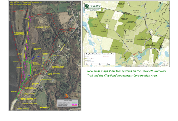
The Hooksett Riverwalk Trail has a new map showing the current trail layout and future enhancements. The map shows new construction on the Brick Kiln Historic Trail Loop, which opened to the public in November.
The kiosk updates describe the wildlife and protected species along the riverwalk, including the bald eagle. It includes the area’s historical significance as the site of the Head & Son Brick Yard (1850-1930).
The Hooksett Riverwalk Trail was opened in 2016. The kiosk was constructed by Oliver Mack and members of Boy Scout Troop 292 for Oliver’s Eagle Scout Project.
")

Northeast of town lies 750 acres of the expansive Clay Pond Headwaters Conservation Area.
Thanks to efforts by Bear-Paw Regional Greenways and the Hooksett Conservation Commission (HCC), the new map shows trail systems throughout the protected and pristine areas. It includes a new trail loop that was constructed last August with oversight by the Student Conservation Commission.
Bear-Paw’s executive director, Katrina Amaral, said, “We hope this kiosk provides a sense of the various land ownership and vast network of trails running through this area. Visitors are encouraged to stay on the trails and be respectful of all wildlife.”
Cindy Robertson, HCC chair, said, “We are thankful to Bear-Paw and members of the commission to have these new updates in place for winter snowshoeing activities and for spring hiking. It is a real benefit to Hooksett to have these beautiful open spaces for our enjoyment.”
Hooksett Riverwalk Trail
To enter the trail, park at the Hooksett Dog Park and look for the trail entrance near the kiosk. Visitors are reminded to be respectful of conservation boundaries and avoid private properties in the area.
Clay Pond Headwaters Conservation Area
To enter the trail, take Whitehall Road to Chester Turnpike. Turn north and proceed for approximately one-half mile to the end of the Class 5 road. Hikers can park along the Chester Turnpike and enter the area at the kiosk. The Clay Pond area is gated to though-traffic.
—JoCarol Woodburn
 Clay Pond kiosk photo credit, Susan Wilderman, Bear-Paw board member
